Mapping of CO2 Sources and Sinks in Europe
Project description
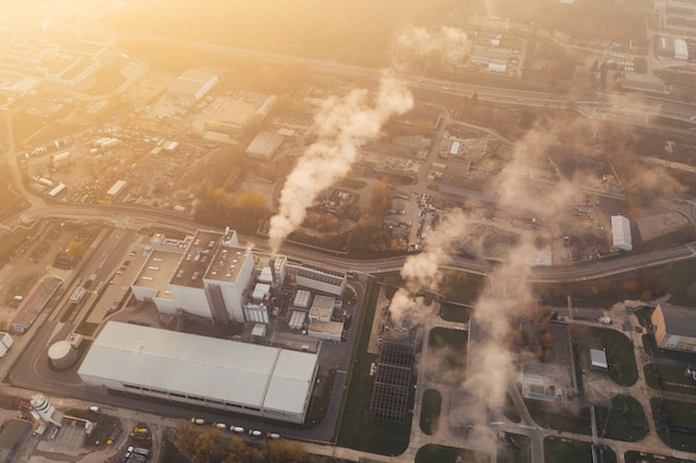
Together with Endrava, Carbon Limits created a tool that gives an overview of the CO2 sources in Europe and helps in the identification of sources with potential to send its CO2 for storage on the Norwegian Continental Shelf.
The tool also includes a review of CCS policies for all European countries and their storage capacities and storage assessment levels. Potential CCS clusters within Europe are also identified in this tool. For each sector, a generic value of the percentage of CO2 capturable has been introduced to estimate the maximum volume that could be captured through CCS on each source. For each source, the distance to the closest port is given.
Carbon Limits was responsible for providing source, harbour and storage data to be analyzed, guiding the tool construction and providing CCS expertise.

